El Cocuy is a national park that encompasses the northern Colombian Andes. Despite being recommended in the guidebooks, it is still considered to be a secret spot. The books make it seem like you should only consider making a trip during the summer months of December and January, and even then you should be a hard mountaineer with lots of expensive equipment. This isn’t the case - the truth is that, despite being a little time consuming to reach, hiking Cocuy is an amazing experience that is easily done with patience, fitness, research and some warm clothes.
I spent 7 amazing days in the mountain cabañas and did three ascents to the glacier. Hiking solo was exhilarating, far better than I thought it would be. For most of the trip, there were no other tourists around at all. I had everything to myself, and yet, the off-season weather was really as good as I could have hoped for, with sun every day and occasional rain that I watched happily through the cabaña windows.
Day 1 - The trip to El Cocuy town
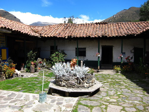
From Sogamoso, I caught the night bus at 12:30am to the tiny town of El Cocuy, a journey that was to take 7 hours. This was a mistake. The road leading up the mountainside was in terrible shape, and the corners were so sharp that the bus thrust violently from side to side and vibrated endlessly over stones and rocks. Sleep was impossible. Groggy but glad to be off the nausea machine, I checked into a local hostel, a beautiful old colonial building with only 3 other guests.
Around town in El Cocuy, I bought some snacks, a beanie, scarf and warm gloves. In the evening, I met 3 Germans who had just spent 2 nights up in the mountains and I gleaned a few tips off of them. I learned that the flagship 6-day trek around the back of the Sierra Nevada was closed, due to a combination of political wrangling, actual contamination of the water by people and horses, and complaints from the indigenous people. Not a problem, it was the day hikes I was after, and those were all still open.
Day 2 - The milk truck, Cabaña Sisuma and Las Lagunillas
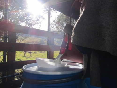
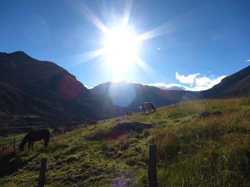
Above the town of El Cocuy there’s a dirt road that circles up into the mountains passing the many scattered farms, the couple of entrances to the national park, and the cabañas and campgrounds. It eventually loops around back down to another town called Güicán before coming full circle. There are hardly any cars on this road, and thus the only way to get up there is by catching a ride on the milk truck (El Lechero). This truck leaves at 6am from the main square, and slowly traverses the mountain collecting milk from all the farmers. El Lechero is a part of the lives of the people of El Cocuy, it’s used as public transport and as a local delivery service, but of course only does one round a day, in the same counter-clockwise direction.
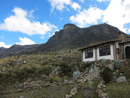
From where El Lechero dropped me off, it was still another 8.5km hike to the first cabaña I was aiming for. Not too bad, but with all my bags weighing me down, and stunted breaths due to the altitude of 3800m, it took about 3 hours. Finally, I arrived at Cabaña Sisuma at 4000m, an isolated outpost at the foot of the first trail, inaccessible by vehicle yet surprisingly solid looking.
Cabaña Sisuma was staffed by 3 Colombians, full of smiles and friendly to a fault. They prepared food and generally were there to make sure you returned at the end of the day’s hiking. The cabaña itself, despite looking pretty well crafted, had some major flaws - mostly around the subject of insulation. There was none. It appeared that the planners had not even taken such a wild luxury as the indoor temperature into consideration.
So of course, it was bitterly, bone-chillingly, achingly cold. Approaching zero degrees celsius indoors. Freezing. Being so remote and so high, there weren’t many trees around, meaning that despite having a fireplace, the best the staff could rustle up was a few twigs. There was no heating, no hot water, no electric blanket. The only place that you had any hope of warmth was in bed, under 5 blankets that seemed more like carpets they were so thick.
So that’s what I did - if I wasn’t hiking, I was in bed with my laptop. By setting it to mindlessly encode videos at 100% CPU use, it would heat up to a toasty 40 degrees and keep my hands from getting frostbite. Did I mention that they had WiFi internet? Yes, the remotest cabin in the remotest mountain where there was no possible way of getting warm, had WiFi. At least I was able to complain over instant message to anyone who was online.
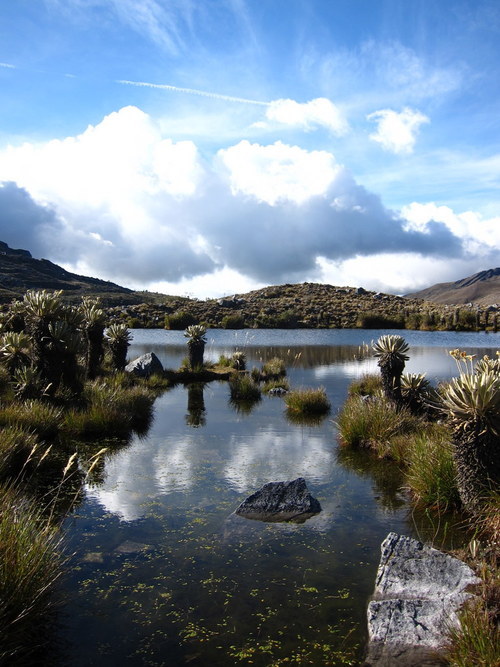
I did a short but stunning hike up to the various lagoons called the Lagunillas, just a couple of hours and a good warm up. Bed by 8pm.
Day 3 - Púlpito del Diablo and Pan de Azúcar
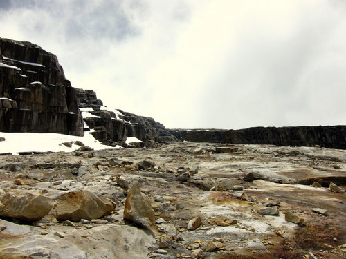
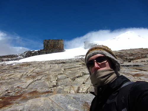
The Devil’s Pulpit and Sugar Loaf, in English. On day 3 I set off at around 10am for the two highlights of the area, a bizarrely well-cut rock formation and the glacier surrounding it. The trail was very steep, like walking up a vertical staircase for 3 hours, and the altitude made it even harder, but eventually I arrived at the base of the glacier just as the weather cleared up magnificently.
Day 4 - Trekking to La Esperanza
My goal was to sleep at 3 different cabañas, but logistically, getting from the first to the second isn’t as easy as the others. It’s possible to hitch a ride with El Lechero at 7am when it passes, but just to get back to the road would be a 2 - 3 hour hike, meaning an unacceptable wake up time of 3am. Instead, I decided that I’d hike the whole way to the next cabaña, Hacienda La Esperanza, rather than wake up that early.
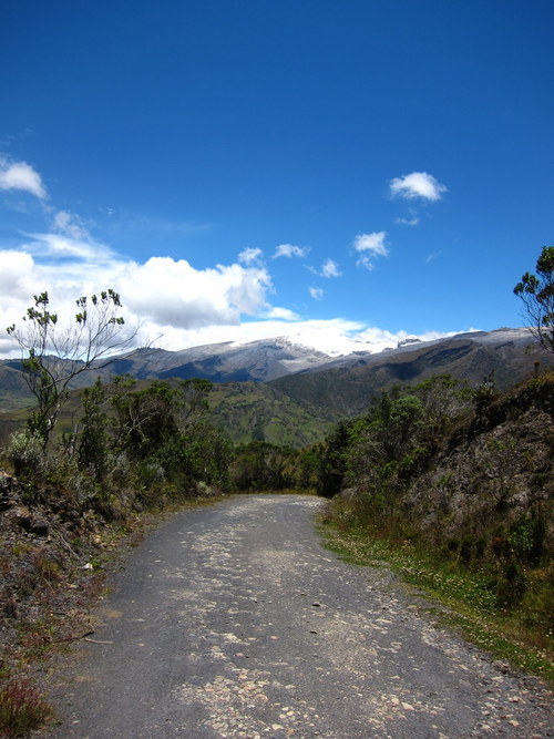
The 15km hike turned out to be mostly downhill, and spectacular in it’s own right. I made it to the road in 2 hours, and then took another 2 hours to reach La Esperanza, arriving in time for lunch. The only issue was the weight of my two backpacks, probably 23kg+ and badly packed. The shoulders definitely took strain.
La Esperanza was much warmer and had a hot shower. The old boy staffing the place also knew his way around the kitchen, which was a welcome change. I was the only guest in the ancient old building, and the family were very welcoming and hospitable.
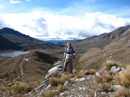
Day 5 - Laguna Grande de la Sierra
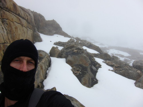
My goal for the day was to make the ascent to 5000m, which the maps seemed to indicate was possible, as long as I could somehow get around the glacier to the back of the peak. Walking on top of the ice was not an option, as it’s dangerous without the right equipment.
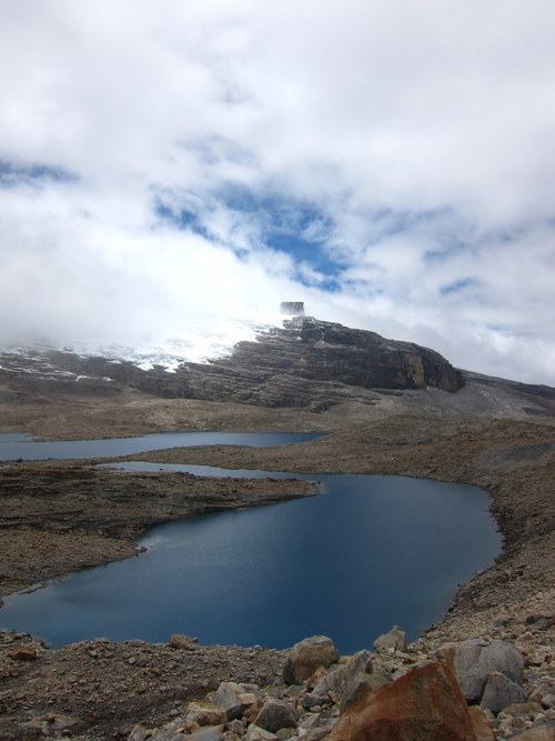
I made it in good time to the lagoons at 4600m, but the visibility was bad, and I couldn’t find the trail that supposedly circled the glacier. So I continued on the main path, hoping for a breakthrough. After reaching the snow line I hiked up to at least 4850m, however there was increasingly less rock to walk on and more snow to sink into. Eventually I had reached a dead end, and decided that the 5k mark would have to wait - I couldn’t get a GPS altitude reading in the clouds anyway, so even if I had ascended far enough I wouldn’t be able to tell.
Half an hour later, back at the Laguna Grande, the clouds cleared up allowing me to look back at the path, confirming that it was a dead end. Next time.
Day 6 - Cabañas Kanwara
The best part about Esperanza was that the milk truck stopped right outside the door at 8am. I hitched a ride all the way to the turn-off for my last stop, Cabañas Kanwara. From there, it was still an hour hike up to the 4000m mark where the cabañas were located.
My heart sank a little when I noticed the large bus parked alongside the registration desk. The cabañas were all full with a large party of Colombians, except for one tiny loft room that I could have if I wanted. Since they were all leaving the next day and I could have the whole thing to myself thereafter, I decided to take the loft room.
The large group turned out to be a class of University students studying tourism management, and the loft room that I was occupying happened to be in the cabaña with eight 20-year-old girls in it. They were thrilled, and insisted on hearing stories about every country I’d been to as well as seeing every single photo on my laptop. I didn’t have a moment’s rest, their questions and my responses in broken Spanish went on all night.

Day 7 - Ritacuba Blanco
I set off early, intent once again to break the 5k mark. The weather held nicely, and I aimed for the main trail all the way up to the glacier’s edge. At 10am I had run out of trail - but only reached 4950m. Having suspected this might happen, I had another plan - to climb the rocky pass alongside the ice where the contour lines indicated a climber could get higher.
The pass wasn’t entirely off-trail, as small stone pyramids placed by other climbers marked the ascent. Climbing at that altitude was surreal, an intense tiredness overwhelming the body with every step. I had to leave my backpack at the base as just those few kilos made a huge difference. Eventually I felt confident to take a reading on the GPS - 5022m above sea level.