I flew on a chartered business trip yesterday, to Warburton, Mpumalanga. Our destination runway is situated just above Swaziland, and the airstrip buildings are primarily a control room for fighting forest fires. The main forester in the area is Sappi, but there are a few other private farms that need the fire fighting service.
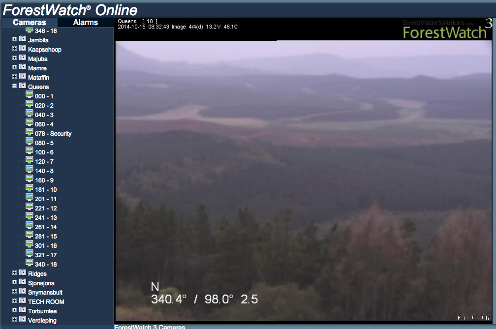
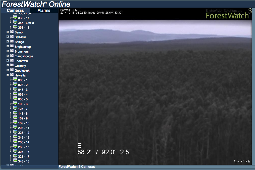
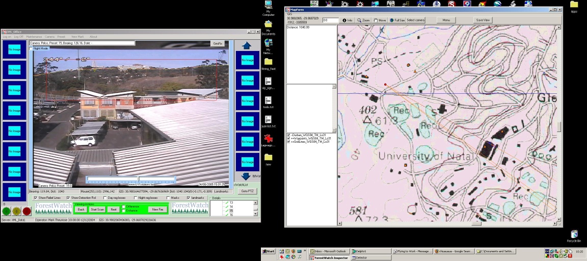
ForestWatch is the software system that we created and maintain, used by operators to manage fire emergency response. In the screenshot is an example of what it looks like, on the left screen you see the images coming from the camera above our office, it’s facing the University of Natal. I’ve clicked on the video screen, and on the right you can see it’s automatically brought up the map of Durban showing me exactly where my click on the screen is on the ground. There are orange lines drawn to the University buildings (the black blobs) which indicate the camera’s field of view. This is a very helpful feature for operators - no more guessing where smoke is, you can get a location instantly.
Operators can mark fires and then manage them over time. They also show up on other cameras, so you can’t mistake it for a new fire. Our primary magic sauce is that our software can detect smoke automatically, and it will create an alarm when it does, so the operator can manually inspect it much sooner than if they were simply browsing the screens one by one. It will also contain the land ownership database, and much more.
There are many large towers set up around the area, each one with a camera on it. The cameras scan the surrounding forest, and beam the information back to the control room, using either analog signal or wireless digital networks. At the moment, there are operators that watch the camera screens looking for smoke. In the past, another company was contracted to provide the towers, cameras and control room computer software, but they’ve lost the contract, so we flew in to inspect and assess what changes were necessary to get our software and camera systems in.

This is the control room from the inside. There are 6 cameras here, and the operator sits and watches them all day. Those radios on the right are used to contact the ground crew and get them to investigate suspicious smoke. The maps are of the surrounding area, and they show you the location of the camera as well as the contact details of the owners of all the surrounding farms and plantations.
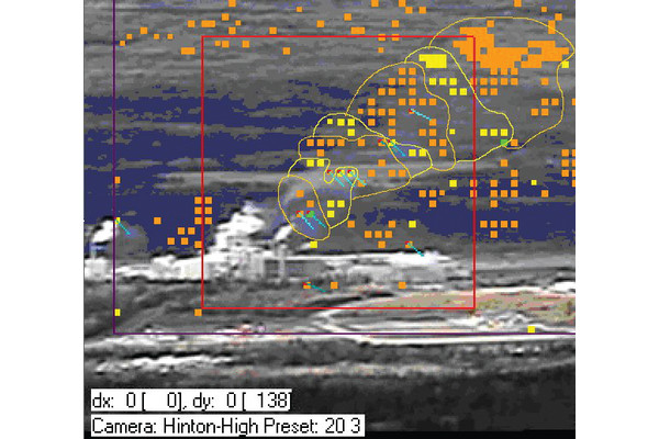
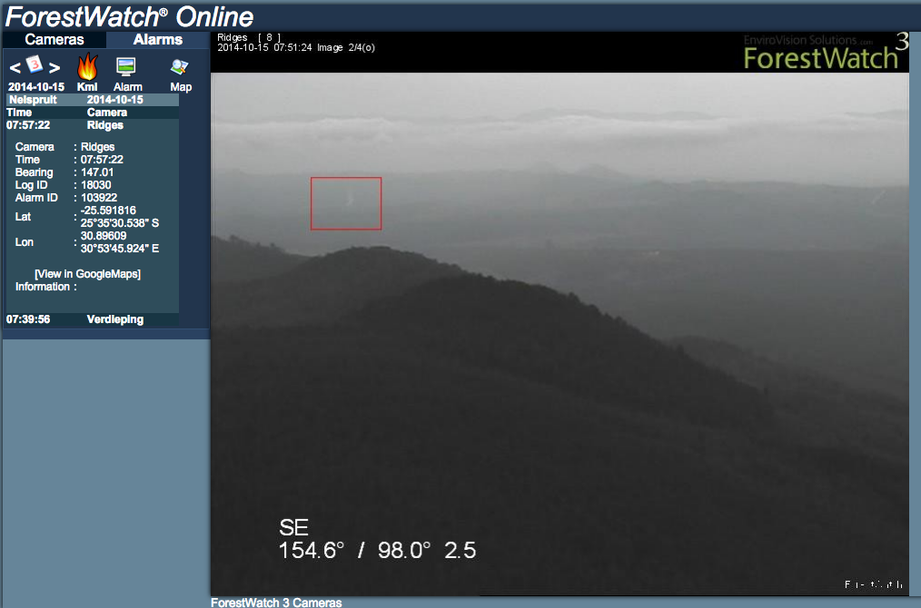
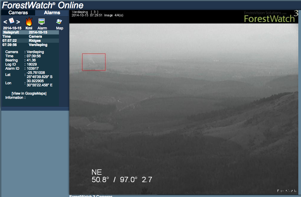
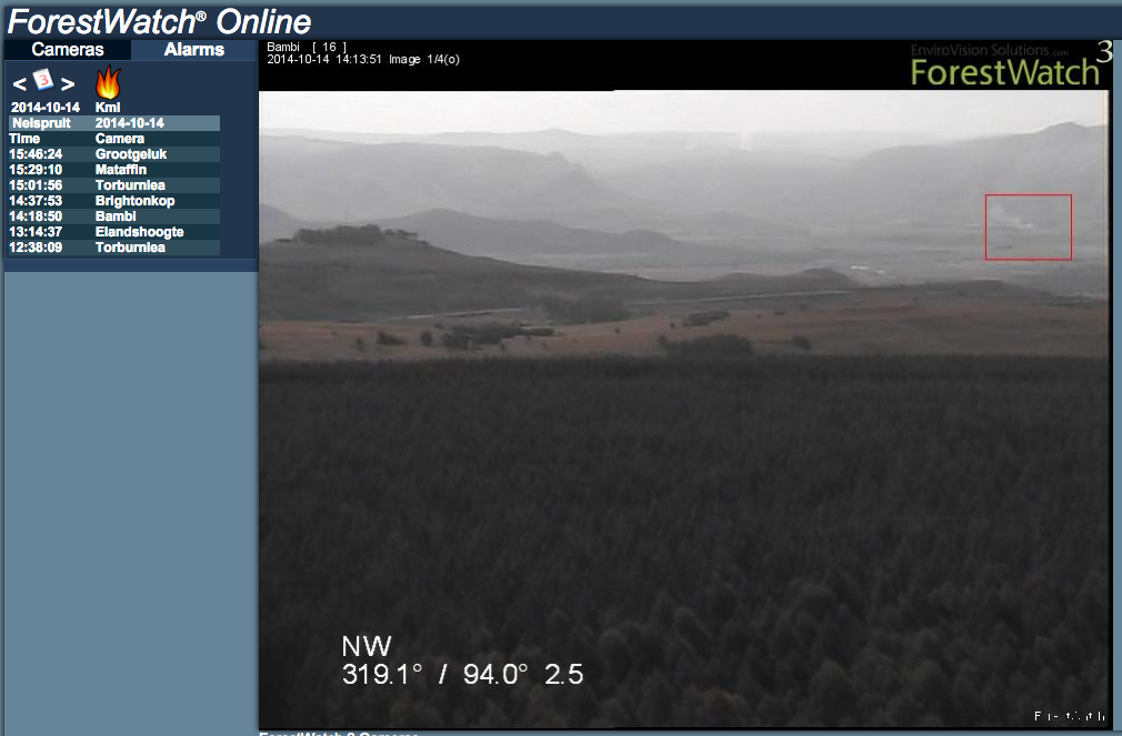
The job of the operator is to monitor anything between 6 and 20 cameras, all looking at miles of forest. Now imagine that you’re the operator and on one of the screens you spot smoke.
How do you know where that camera is pointing? It’s hard to tell, because each camera is set to pan-tilt-zoom sequentially through 20 or more presets. If you don’t know where the smoke is, you can’t get hold of the right manager to alert that there’s a fire somewhere - remember that the land is not all owned by the same person. Sometimes the fire is in a valley, and you aren’t sure where it is exactly. Sometimes it’s the same smoke that you’ve looked at from another camera and you don’t have to report it again. It’s not easy to manage all this stuff manually, which is what the operators currently do at the Warburton control center.
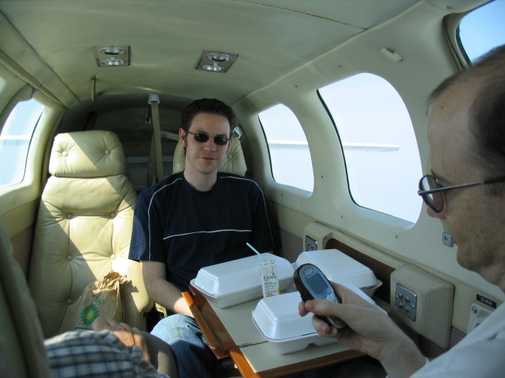
The team picture taken from inside the plane shows Gareth in the middle, he’s the other software developer, and Kevin on the right is the chief scientist.
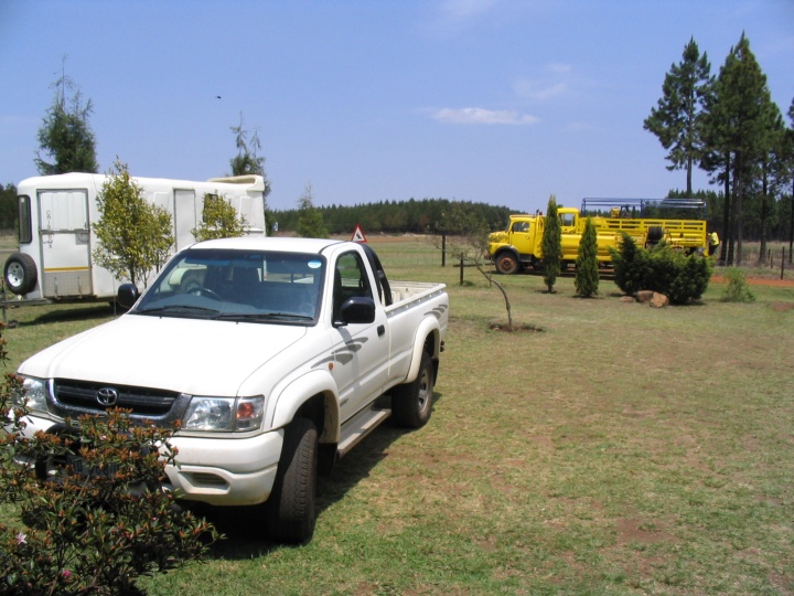
Outside the control room, a yellow fire truck that is dispatched around the countryside in the event of a fire.

This is a view of a smoke in the midlands. This is the kind of thing that the control room needs to identify and alert on: where it’s coming from (factory, plantation, braai, etc.), who is controlling it, and if they have a permit to burn. There are hundreds of fires which need to be managed so that they don’t miss a natural, uncontrolled one.
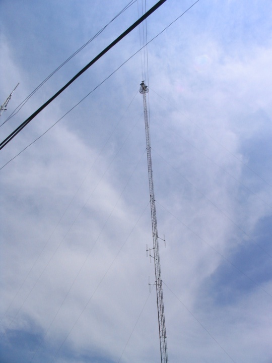
The second picture is of a very tall style of tower - note: there’s a camera at the top of that. These are the large ones, you need a harness and a head for heights to climb it! The antennas on the sides transmit video back to the control room.
As you might imagine, these things get struck by lightning all the time, so maintaining them is an expensive undertaking. They generally run off batteries that are charged with either solar panels or wind generators. The panels are often stolen and used in households which adds another dimension to the cost and maintenance.
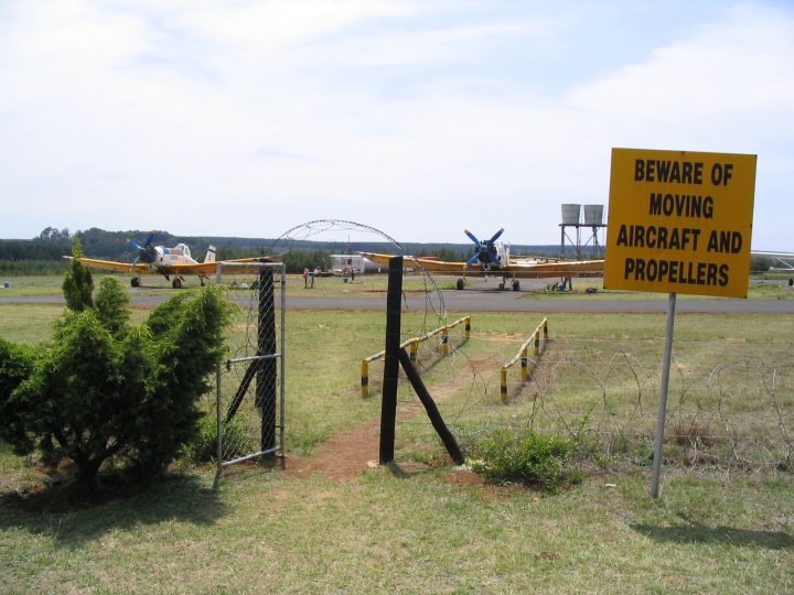
These are the bomber planes, which carry up to a ton of water and drop it on the wildfires. When they take off, they make so much noise the entire place shakes violently! They’re dispatched to fires a couple of times a week. Sappi and the foresters make the final call as to whether they want to dispatch a plane, because it costs a lot of money.